![]()
Beichatian is in my opinion one of the best days hikes you can do in the north of Taiwan. It’s high, 1700m+, and a tough hike, especially if the weather is bad but the scenery and the challenge more than make up for it.
The last time I came to Beichatian was during the summer when I hiked from Manyueyuan 滿月圓. It was really hard work in the heat but I enjoyed it immensely. When we got near to the top a park ranger of sorts chatted with us and mentioned that the hike could also be done from Xiao Wulai 小烏來.

- The forest near the beginning of the trail

From Manyueyuan, it’s a least an eight-hour hike, more if the weather is poor but from Xiao Wulai it only takes arouind 5-6 hours. To get to there, we drove to Sanxia from Taipei and then along the number 7 (The North Cross-island Highway). The turn off is about 15mins after the village of Fuxing.

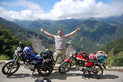
The start
Immediately after pay the entrance fee, (60NT for motorbike, more for cars) we caught a glimpse of the famous Xiao Wulai waterfall. It’s beautiful but I didn’t take a picture mistakeningly thinking I’d have time to do it on the way back down.

The trailhead is some way into the park area and it took a further 20 minutes of driving to get there. At the bottom there’s a car park of sorts (muddy field) and they charge a 100 dollars for cars. Motorbikes can go a little further up the road and park right next the trail for free.

The trail is really muddy on or after rainy days!
On this day the weather was very changable. One second the sun would come out and it would be a perfect temperature, the next second the wind would pick up and it would start raining. It can be a very muddy place to be and this makes the going that much tougher. You have to think about every step, especailly on the parts where you need to scramble as it’s so easy to take a fall.

Light shining through the trees

By the end of the hike I had mud everywhere, including my face!
From the beginning, the forest is very beautiful and as we ventured further in the sun began to come out more and more. After and hour and a half, we reached a fork in the trial and took the right branch. It led to an area of huge, giant redwoods. I’ve seen trees like this in California that are bigger but the redwoods here seem so much more impressive and it’s prehaps beause of the more natural setting. No buses full of tourists flying past.

One of the giant redwoods, would guess it's about 60m high
There are dozens of these redwoods scattered about on the trail and each one seen to be more spectaular than the last. My favourite is the one you need to walk through to continue below.

Walk through this one

Huge buttress tree roots
Shortly after the redwoods, we met up with the trail that comes from Manyueyuan and this is where the real hiking begins. It is very, very steep and there are lots of roped sections and home-made ladders to aid climbers. The closer we got to the top the worse the weather became and the chances of getting a good view disappeared.

Scrambling up the steep slope

Rodger clings on for dear life!
Another thing that makes this area famous is the 紅毛櫸 which I think are elm trees. Typically in Taiwan at lower elevations trees never really lose thier leaves. However up on Chatianshan, for a brief period of time, the elm tree leaves turn into beautiful red, orange and yellows and then drop. It only occurs for a very short time, prehaps a couple of weeks or so and it seemed we were just too late as most of the leaves had already fallen which was a shame.

Some of the autumnal leaves still cling to the trees
At the top we ate and then quickly headed down as it was freezing cold! Not sure how I’m going to cope with Snow Mountain in a couple of weeks time where it might be minus 10!


Just made it down before dark

A strange creature in the forest
More photos of this trip and the trip from Manyueyuan
Practicalities
Bring water and food from wherever you set out. The last store is by the gas station in Fuxing.
It’s possbile to get to Xiaowulai by bus from Dasi in Taoyuan county but the trailhead is a long way into the park and I doubt that the bus goes that far. Best to drive or hire a scooter.


Hi Stu,
You have a great blog, especially for people who like do some hiking.
I’m starting to hike here in Taiwan (I’m permanent resident) and I would like your advice about places to go, especially with more precise address to get there. Maybe next time you want go for a day hiking (also camping) I can join your trip. I have a car, so, if is convenient, we can go together.
Anyway, hope get chance be in touch with you.
Adolfo
Hi Adolfo
Two good places to start are Huangdidian and Wuliaojian. There are maps at the bottom of each post and some details for how to get there. Next time I organise a trip somewhere I send you an email.
Stu
Nice blog – I check it regularly for hiking and road trip ideas. We’re going to the Xiao Wulai waterfall next weekend.
My friends and I are trying to hike some mountains over 3000m in or near Hsinchu county. The first one we did was Snow Mountain a couple of weeks ago, but for the next few we’d prefer to scooter there and stay Friday and Saturday nights.
We considered dabajienshan but we were put off by hearing we would have to hike 20km just to get to the trailhead. Do you have any more suggestions for 3000m+ hikes nearby?
I’m not too sure about any in Hsinchu other than Dabijian.
It’s a bit far from Hsinchu but you could have a look at the Sixiu near snow mountain. The only problem will be getting permits for a weekend, a lot of competition. https://apply.spnp.gov.tw/ They open the site at 7am and you need to be on there and apply as soon as it opens.
Nenggao is another good one and you don’t need a park entry permit, just the normal mountain entry so there’s no limit to the number of people.
[…] Bei Cha Tian Shan 北插天山 One of the redwoods on the Xiaowulai route to […]
hey stu! i love your site and my boyfriend and i regularly check it to find some cool day hikes around taoyuan. we were wanting to do this hike from xiaowulai, but we can’t find it on google maps anywhere! do you think you could post a map on how to get there?
I’m 90% certain that it’s here 24.798526,121.42023. We just headed into the Xiaowulai area. Passed through the village and the school and kept on going to almost the end of the road. There were small signs written in Chinese by the sides of the road. There’s a field where you can park a car for $100NT or if you’re on scooter, go up a little bit further and park at the entrance to the hiking trail. It’s marked on the right with lots of plastic tags.
Is it 5-6 hours round trip, or 5-6 hours each way. Thanks!
Round trip
Want to get out during a stopover. We are avid hikers and are staying next to airport. Is this hike good to go in December? Any recommendations otherwise? Thanks
Hi
Yeah it’s a great hike. But you’ll need your own transport to get there.
Stu
My wife and I are avid hikers coming in for a stopover for a few days. Is this hike good to go in December? We are staying next to the airport. Any other recommendations?
I have a 2yr old hiking dog (土狗) who loves to go hiking with me. I wanted to take her out on this hike, but I am worried about the fixed rope sections. Do you think it’s possible to take her along?
How much would a taxi cost me from Taipei? I will only be in the city for 4 days or so, but I really want to hike. Would it be better to hike Wuliaojian? Thank you!
You need a permit now for beichatian so wuliaojian is probably better. A taxi from youngning MRT station would probably cost about $300
Hey!
I am looking for a nice hike that I could to with kids, and with a camping spot to spend the night. Do you know of any place like this in Taiwan, or mainland China (I live in Shanghai)?
Thanks a lot !
Hello.
Thanks for your blogs. They have been super helpful. It is fun trying to track down these trails as best I can.
As an update, this trail is closed. The
Ah. And I didn’t know you needed a permit for this trail until just now.
Is there a place to camp near Beichatian? I have been looking for camp sites with easy access to hiking trails.